State Violence on the Map- How Urban Geography Is Weaponized in Kurdistan
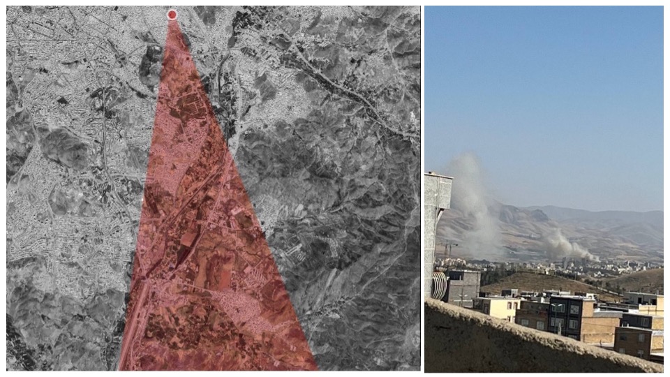
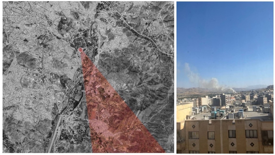
During the twelve days of Israeli airstrikes against the Islamic Regime’s military installations in Iran in June of 2025, most attacks targeted areas around Tehran. On June 15, the Israel Defense Forces (IDF) announced that targets in western Iran would also be struck. One of the locations hit, and which has significant military importance, could potentially be a major blow for the Islamic Regime.
Photographs taken by residents in Sine (Sanandaj), one of the largest cities in Rojhilat (the Kurdish region in western Iran), showed smoke rising from the Imam Ali military base in the southern part of the city.
Social media videos soon confirmed that airstrikes on the base went on late into the night and continued over the following nights. Targeting this base drew significant attention among Kurds in Iran, as the site holds a distinct place in the region’s recent history.
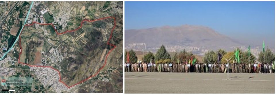
Imam Ali Military Base
Starting with its use in the 1979 Revolution, and then the Bloody November of 2019 and the Woman, Life, Freedom protests, the Imam Ali base has come to be known as more than a geographic landmark. It has played a central role in security operations and repressive protest management in the region.
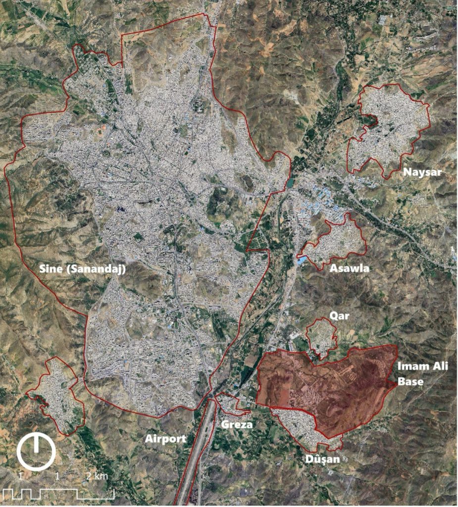
The military base sits on the edge of Sine’s poorest neighborhoods – Dûşan, Greza, Asawla, and Qar – where the majority of residents rely on low-income work such as street vending, construction, and cross-border portering/kolber between Rojhilat and Bașur (Iraqi Kurdistan) and are often targeted by the Iranian government as they struggle to earn a living.
Due to the base’s strategic location, the communities living in its vicinity have limited opportunities for protest or major resistance.
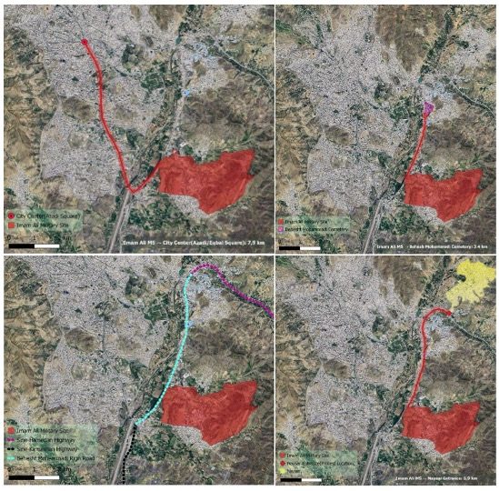
Its proximity to Sine Airport – less than 1.6 kilometers – is an integral factor for the impact it has had: the airport is seldom used for commercial flights but has served as a landing point for security forces brought from other regions during periods of unrest. This was apparent during the rapid deployment of forces from Yazd, Hemedan, and Kirmaşan (Kermanshah) in mid-October 2022, when local units lost control of Kurdish protests.
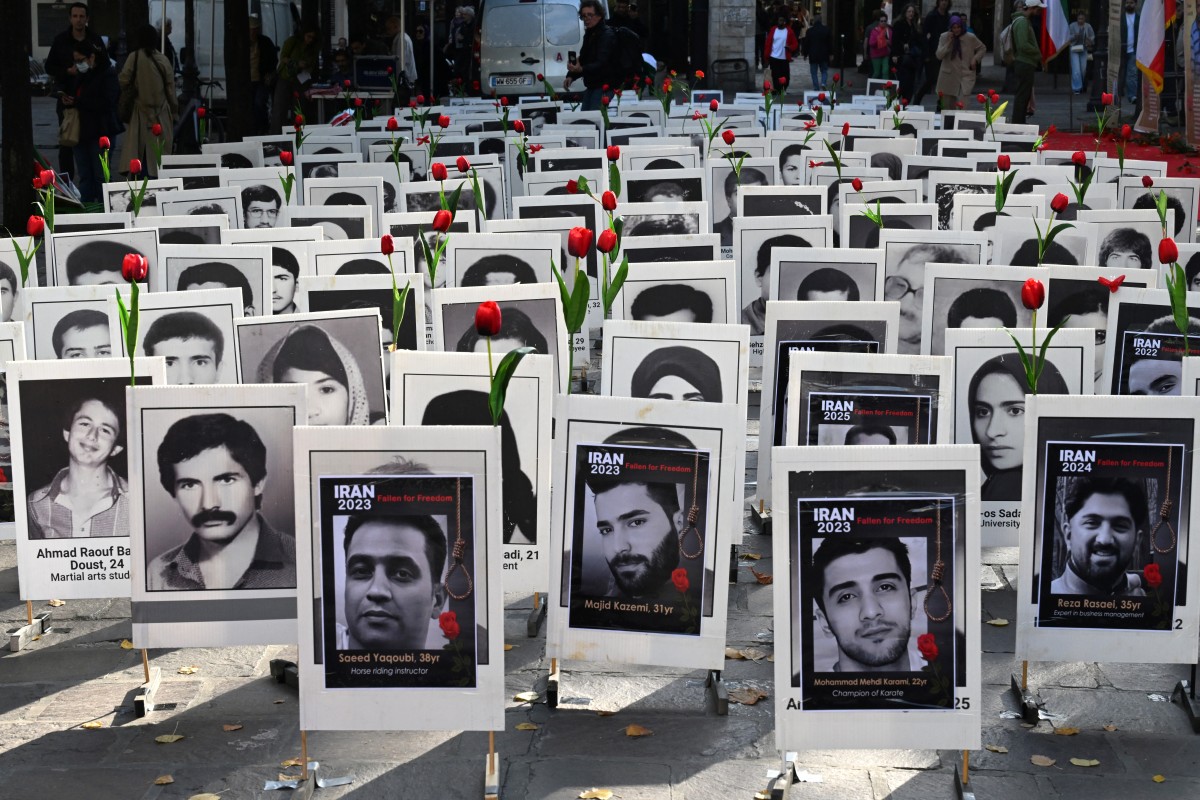
Going back further in history, during Khomeini’s 1979 campaign, known as the Jihad against Kurdistan, Sine Airport became a central command point where many Jihadists involved in the campaign were stationed. As a result, it was one of the sites where the Islamic Regime committed human rights violations and mass executions against the people of Rojhilat.
Numerous photographs from that period – regularly republished by IRGC forces on state news agencies and social media accounts – show these units positioned at the base, further indicating its operational significance.
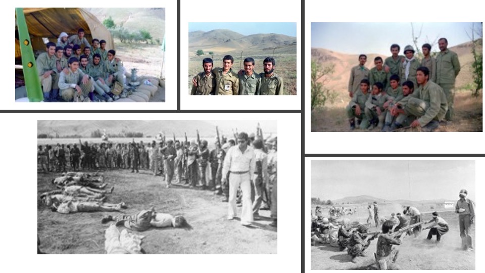
Below: Pulitzer Prize–winning photograph by Jahangir Razmi documenting the execution of Kurdish prisoners at Sine Airport in the early years following the Revolution.
Infrastructure for Violence
The Behesht Mohammadi Circular highway was constructed near the base to connect Sine’s entry and exit routes to Hemedan (Hamedan) and Kirmaşan without requiring passage through the city’s congested areas. The highway’s position has facilitated rapid ground deployment and stationing of security forces in Sine.
Reports have shown the arrival of units from Hemedan Province at the base during the anniversary of the Woman, Life, Freedom protests, as they quickly joined security operations already underway.
The highway also links the base to Naysar, one of Iran’s largest informal settlements and a recurring center of protest activity, as well as to Behesht Mohammadi Cemetery, where memorials are frequently held for those killed in the protests.
On November 17, 2022, on the 40th-day memorial for Sine’s victims, when thousands gathered at the cemetery to remember them, security forces used the highway to quickly reach the cemetery. On their arrival, they used live ammunition, killing Şaho Bahmanî and Aram Hebîbî. Even a year later, security forces stationed at the base continued to appear regularly at the cemetery.
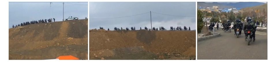
The base is linked to central Sine through Pasdaran Boulevard – named after the Iranian Revolutionary Guards Corps (IRGC), colloquially referred to as “Pasdaran” meaning “guards”, who chronically brutalize civilians. The boulevard has been a frequent gathering place during demonstrations.
Stretching approximately three kilometers, this route saw a major crackdown during the November 2019 protests, when security forces that had deployed from the base used coordinated tear-gas operations near Shalman Bridge to disperse crowds and detain demonstrators. Eyewitness accounts have relayed the scale of the security response across the corridor.
Can People Resist?
A significant event occurred during the violent suppression at Nabowat Square and Kerbasi Hill, when security forces from Yazd Province, after landing at Sine Airport, were immediately deployed to the protest sites. Fully aware of the garrison’s central role in orchestrating these crackdowns – especially during the Woman, Life, Freedom protests – protesters in Sine made repeated attempts to hinder the movement of Regime forces by lighting fires around the base for several nights. Though, despite their continuous efforts, they were unsuccessful and many who protested were forcefully detained – and due to the sheer number of arrests made, detention facilities at city-level security centers were too full – leading to detainees from protests in Sine and Naysar being transferred to the Imam Ali Military base for interrogation.
For decades, the base’s location and operational reach have made it a central chokepoint in the management of protests and the control of movement across the city and its surroundings. It has been integral in solidifying the Islamic Regime’s control over Kurdish areas and a major province along the country’s western border.
For many Kurds in Rojhilat, the base has functioned as an anchor of state security operations during periods of unrest. Its continued use during moments of tension illustrates how spatial infrastructures and security geography shape everyday life in Sine and the wider region.
Soran Mansournia
Soran Mansournia is a researcher and lecturer in Spatial Sciences, Urban Studies, and Political Geography at the University of Groningen, Netherlands. He has contributed to a range of media outlets, including CBC, Middle East Uncovered, NRC, BBC Persian, and The Press (New Zealand). Soran’s work examines the spatial dimensions of state violence and human rights, with a particular focus on integrating geoscience methods with human rights advocacy